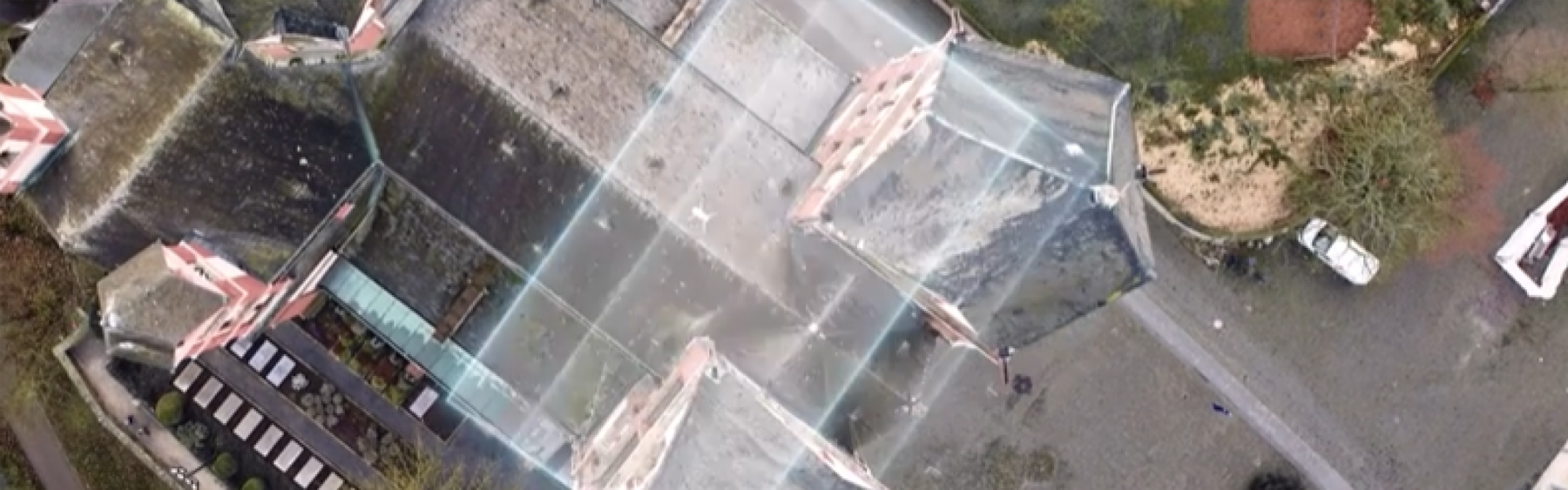
Our drone surveying flights deliver orthophotos, volume reports, and 3D point clouds in many export formats.
![]() Certified operating authorisation with SORA risk assessment
Certified operating authorisation with SORA risk assessment
Precise drone surveyingdeliver data in days instead of weeks
Drone surveying for everyone who plans, inspects, bills, or documents—and needs absolute precision.
Orthophotos & point clouds—ready for CAD/BIM workflows
High-precision photogrammetry delivered as GeoTIFF, LAS & DWG—ready for Revit, AutoCAD & co. Efficiency gains, data capture, portfolio expansion, support on large projects.

FAQ: Drone surveying for surveying firms
Can we receive your raw data for further processing?
Yes, of course. We consider ourselves your "flying team member." Normally, you’ll receive georeferenced images and the final point cloud for planning in your office—but we can also provide you with the raw data.
Can you provide short-term support during capacity shortages?
Yes, that’s exactly what we’re here for. If your survey teams are fully booked, we quickly and flexibly take over field data collection so you don’t have to turn down any projects.
Do you offer your services as a "white-label" solution?
Yes. We can carry out data collection entirely in your name. The end client will only see you as the point of contact. This way, you can expand your portfolio without any upfront investment.
Is the drone suitable for capturing control points?
No. The highest accuracy for establishing a control point network is still achieved terrestrially. The drone is responsible for quickly capturing the area between these points. Using the existing control points, the data collected by the drone can be precisely referenced.
Does purchasing a drone make sense for our office?
Often, working with drone specialists is more cost-effective. The high investments in professional equipment, software, and especially continuous training only pay off with very high utilization.
Ready for takeoff?
Have your asset surveyed from the air and receive precise data that your team can process immediately.
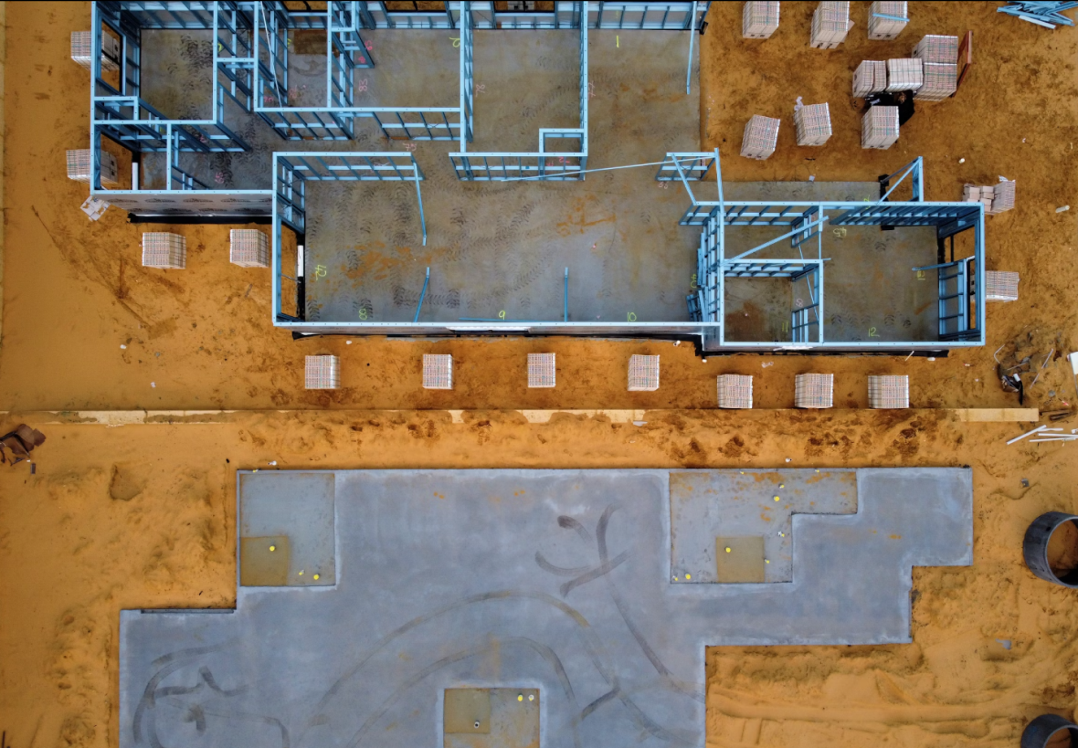
Digital Jobsite with Centimeter-Level Precision
RTK-enabled drone surveying for as-built measurements, progress tracking & claims—directly into your BIM workflow.

FAQ: Drone surveying for construction companies
How accurate is drone surveying for our construction billing?
Our surveys achieve centimeter-level horizontal accuracy and provide an auditable, objective basis for precise invoicing of earthworks and quantity takeoffs.
Can we compare construction progress against our 3D BIM models?
Yes. We provide a precise point cloud or vectorized drawings you can overlay on your design model in your CAD software to instantly visualize deviations.
Does the jobsite need to be halted for drone surveying?
No—your site operations can continue without interruption. The drone flies at a safe altitude while your crews and machines stay productive. The pilot can operate from outside the site during the flight to avoid disrupting operations.
What’s the benefit of a 3D model of the existing structure before renovation?
You design from reality, not old plans. A precise 3D model of the existing conditions prevents costly design errors and ensures a perfect fit.
Is drone surveying cheaper than traditional methods?
Yes. For areas like excavations or terrain models, drone surveying is far more cost-efficient than manual methods thanks to its speed. It also delivers very high point densities that RTK rovers or total stations simply can’t match.
Ready for takeoff?
Have your asset surveyed from the air and get precise data your BIM team can use immediately.
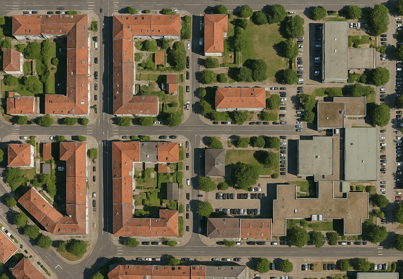
Digital terrain & asset data for offices, utilities, and authorities
High-resolution orthophotos, DTM/DSM and volume reports. Ready for flood protection, land-use planning, and cadastre in the shortest time.

FAQ: Drone surveying for authorities
Are the drone aerial images directly usable in our GIS (e.g., ArcGIS, QGIS)?
Yes. You’ll receive the orthophotos as GeoTIFF files that you can load directly—without conversion—into any common GIS as the current map base.
How up-to-date are the data compared to official aerial imagery?
Our data are up to date to the day. While official aerial imagery is often years old, we can deliver yesterday’s condition—critical for accurate planning.
How are ground control points (GCPs) used in drone surveying?
Ground control points are surveyed reference points on the ground. They ensure drone imagery is precisely georeferenced—producing exact data for construction planning, mapping, and flood protection, efficiently and reliably.
Can you create a digital terrain model (DTM) for flood simulations?
Answer: Yes. We deliver high-precision DTMs that depict the bare terrain. They’re the ideal data basis for hydrological analyses and heavy-rainfall simulations.
How quickly can you create a situation map in an emergency?
Very quickly. We can be on site within 24–48 hours after an event (e.g., flooding) and provide a timely overview map to coordinate emergency services.
Ready for takeoff?
Have your asset surveyed from the air and receive precise data that your BIM team can process immediately.
Drone surveying for roads, rail & bridges
Surveying of corridors, tracks, roads and bridges for design and as-built. Orthophotos, point clouds and deformation analyses for your asset management.
FAQ: Drone surveying for infrastructure operators
Is surveying rail tracks possible without additional safety measures?
Yes. We can capture the track bed from a safe altitude without interrupting train operations. This significantly improves safety and reduces costs.
Can you use drones for vegetation management along rail lines or roads?
Yes. From the 3D point cloud we can pinpoint where vegetation or other objects encroach into the required clearance, ensuring operational safety.
Do you deliver the data directly for our design software (e.g., ProVI, CARD/1)?
Yes—we deliver data in standard formats like LAS and DWG, compatible with all major infrastructure design tools.
How does your method help with alignment design?
You’ll get a complete 3D model of the entire planning corridor in no time. This enables an optimized, more cost-effective, and more environmentally friendly route alignment.
Is flying over highways or rail lines subject to approval?
Yes—but we take care of everything. We hold the required permits and secure all necessary clearances from the relevant authorities.
Ready for takeoff?
Have your asset surveyed from the air and get precise data your team can process right away.
Volume calculation & stockpile monitoring via drone
High-precision 3D models, 3D point clouds—without production stoppage, with data delivery in just a few days for volume calculation, stockpile management, inventory, and documentation.
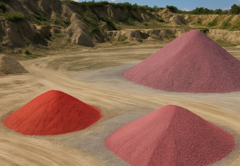
FAQ: Drone surveying for raw material & landfill operators
How accurate is stockpile volume calculation using drones?
Our stockpile volume calculations are accurate to within a few centimeters. This provides reliable data for your inventory, sales, and accounting.
Does the operation need to be halted for drone surveying?
No, your operations continue without interruption. Neither conveyors nor truck traffic need to be stopped for drone surveying.
Can you calculate the remaining volume of our landfill?
Yes. We create an accurate 3D model of your landfill and precisely calculate the remaining capacity for your strategic future planning.
Are the survey data valid as evidence for authorities?
Yes. Our objective and transparent survey data and reports serve as recognized, auditable evidence for tax authorities or environmental and mining offices.
Why use a drone instead of a GPS rover?
For safety and quality reasons. No one needs to enter the stockpile on foot. Additionally, the drone captures millions of data points, resulting in a much more accurate 3D model.
Ready for takeoff?
Have your asset surveyed from the air and receive precise data that your team can process immediately.
Safety first: OurOperating permits
FlyHigh is authorized for drone flights in Germany, Poland, Switzerland, and Austria—including urban zones and sensitive airspaces. Other EU countries can be added within 2-4 weeks.

Within populated areas

Near critical infrastructure

Over industrial or construction sites

Below the regular airspace
The permits are based on standardized risk analyses (PDRA/SORA) and require extensive safety measures, which we, as a certified provider, fully comply with.