Rotor blades, PV arrays, roofs, or industrial plants—we inspect your assets without contact and in the shortest time.
![]() Certified special flight authorisation under SORA
Certified special flight authorisation under SORA

Detect and remedy defects faster with drone inspections
Drone inspections deliver RGB and thermal data that can be fed directly into your maintenance or asset management—without any plant downtime.
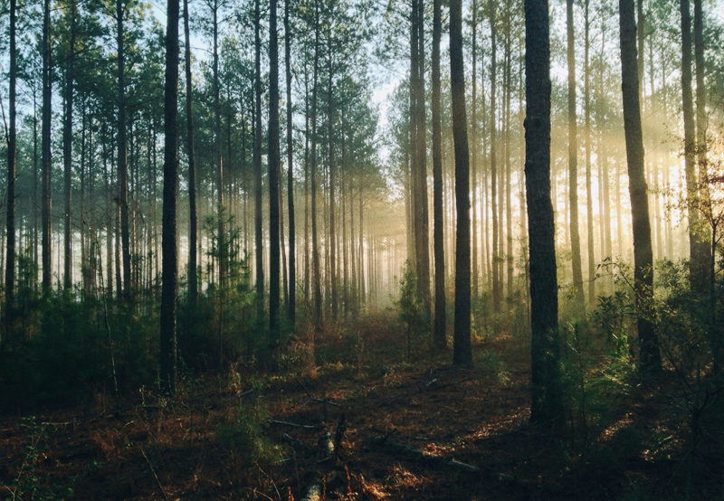
Modern aerial inventory monitoring
Drones unlock new possibilities for farmers, forestry operations, and agricultural cooperatives. With high-resolution sensors, we deliver exact data on plant health, forest stocks, and water balance—far more flexible and cost-effective than aircraft or helicopter missions.
FAQ: Drone inspection for Forestry & Agriculture
How much does a drone flight cost for my operation?
Costs depend on area size and service. For most operations, a flight pays for itself on the first run through saved time and more targeted actions.
What exactly does a multispectral capture provide?
You’ll see plant stress and nutrient deficiencies before they’re visible to the human eye. Fertilise and treat selectively instead of blanket applications—saving materials and protecting the environment.
How does the drone help with bark beetle monitoring?
Our drone detects infested trees even in dense stands. You’ll receive a map of problem areas and can selectively remove individual trees.
Why do you use the M400 for agriculture?
The M400 offers long flight times for large areas, a rugged build for all weather conditions, and versatile specialist sensors to suit your needs.
Do I need a permit for flights over my fields?
No, as the landowner you don’t need an additional permit. We hold all operating authorisations for legal flights across Germany.
Ready for takeoff?
Let’s see how drone technology can support your operation. From the first consultation to the final analysis—we’ll support you every step of the way.
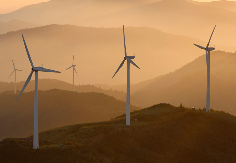
Blade check & PV thermography in record time
For wind, solar, power lines, biogas plants, and energy infrastructure. Rotor blades, bearings, and modules are captured in a single flight. Operations are not interrupted.
FAQ: Drone inspection for wind & solar parks
Does my wind turbine need to be shut down for a rotor blade inspection?
Yes, the turbine should be braked (e.g., via remote maintenance) - however, securing with bolts as in conventional rope-access inspections is not required for drone inspection.
What faults can a drone detect on my PV system?
Our thermography drone reliably detects all yield-reducing faults such as defective cells (hot spots), failed strings, glass breakage, or delamination.
Will I receive a report that my solar installer can use directly?
Yes. The report documents each defect with a photo, thermal image, and exact GPS position. Your service team will know exactly which PV module is affected and can re-measure the performance of the relevant modules if needed.
How good is the image quality for rotor blade inspections?
Excellent. With cameras featuring powerful optical zoom, we can clearly identify even tiny hairline cracks or leading-edge erosion from a safe distance. Thermal cameras also reveal internal blade defects (e.g., delamination).
Can a drone inspection increase the yield of my PV system?
Yes. Quickly fixing the defects we identify can raise your solar park’s annual yield by a few percent, according to studies.
Ready for takeoff?
Have your asset inspected from the air and find potential defects faster.
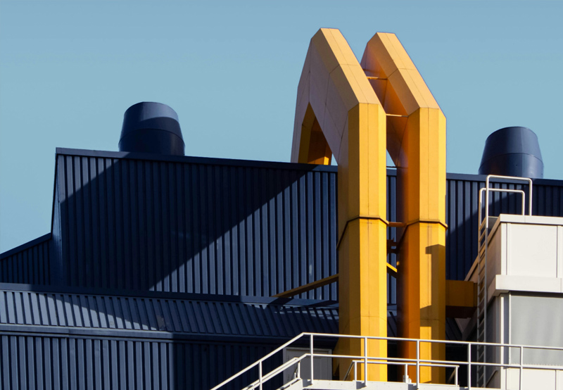
Maintenance 4.0: Plant inspections during ongoing operations
Predictive maintenance, corrosion, leak, and hot-spot detection. RGB & thermal data in a single flight, smart 3D models captured up to 40% faster, report in a few days—all without downtime.
FAQ: Drone inspection for industrial clients
Does production have to be stopped for a drone inspection?
No. In 99% of cases your production continues without interruption. We inspect from a safe distance during live operations.
Is a drone inspection inside tanks or silos possible?
Yes. We use special caged drones for safe indoor inspections, often eliminating the need for hazardous manual entry.
How does a drone inspection help prepare for a TÜV inspection?
It provides the inspector with a detailed visual pre-assessment of the asset’s condition, enabling a more targeted and efficient TÜV main inspection.
How much money does a drone inspection save compared to scaffolding?
A great deal. By eliminating costs for scaffolding, cranes, and especially prolonged downtime, savings of 50–70% are not uncommon.
Can your drone also detect gas leaks along pipelines?
Yes. We can equip our drones with special gas cameras to quickly and safely locate even the smallest leaks in gas or compressed-air lines from the air.
Ready for takeoff?
Have your asset inspected from the air and find potential defects faster.
Digitally inspect bridges, tracks & roads—without lane closures
Condition assessment of bridges, dams, rail systems, towers within days. No traffic disruption.

FAQ: Drone inspection for infrastructure
Is your inspection suitable for bridge inspections in accordance with DIN 1076?
Yes. Our high-resolution imagery is a recognised, efficient method for regular bridge inspections and provides the inspecting engineer with an ideal working basis.
Do we have to close the highway for a bridge inspection?
No. In most cases, no closure is required for a drone inspection. It saves significant costs, avoids congestion, and improves safety.
How well can cracks in concrete be detected with the drone?
Very well. Our camera systems can capture crack widths in the millimetre range and precisely monitor their development over time.
Can the drone also inspect the underside of a bridge?
Yes. We use special drones with upward-facing cameras to seamlessly inspect the hard-to-reach undersides of bridges.
How safe is a drone inspection near railway overhead lines?
Very safe. We always maintain a generous safety distance and coordinate every flight along rail lines closely with the operator to eliminate any risk.
Ready for takeoff?
Have your asset inspected from the air and find potential defects faster.
Roof & facade checks without scaffolding
Roof, facade, and general building inspection—no cherry picker or road closure required. Thermography analysis and documentation with high-resolution detail photos.

FAQ: Drohneninspektion für Facility & Dach
1
1
2
2
3
3
Ist eine Drohneninspektion in der Innenstadt erlaubt?
Ja. Wir verfügen über alle notwendigen Genehmigungen für den legalen und sicheren Drohnenflug in besiedelten Gebieten und kümmern uns um die gesamte behördliche Abwicklung.
Wird die Privatsphäre meiner Mieter bei der Inspektion geschützt?
Absolut. Die Privatsphäre hat oberste Priorität. Die Flüge werden angekündigt und der Fokus liegt rein auf der Gebäudehülle.
Ready for takeoff?
Have your asset inspected from the air and find potential defects faster.
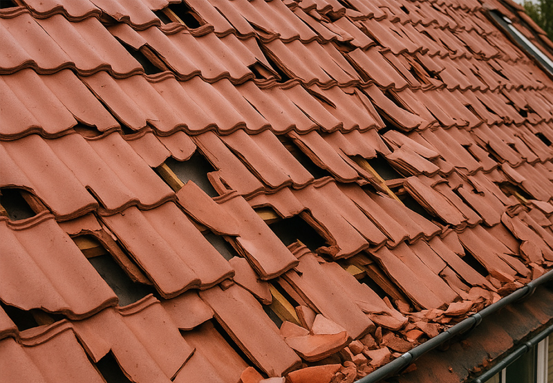
Settle storm & hail damage faster
Fast, safe damage assessment, documentation, fraud prevention Fast and safe damage assessment, documentation, fraud prevention
FAQ: Drone inspection for insurers & loss adjusters
How quickly can you perform a damage assessment after a hailstorm?
Very quickly. We can usually be on site within 24–48 hours in the affected area to speed up your claims process.
Are drone recordings admissible as evidence in court?
Yes. Our high-resolution, georeferenced, timestamped imagery serves as objective evidence and is accepted in court proceedings.
Does the drone replace the loss adjuster?
No—it’s their best tool. The drone provides the loss adjuster with a complete, safe, and detailed overview of the damage in no time.
How does a drone inspection speed up claims settlement?
It eliminates time- and cost-intensive steps such as waiting for scaffolding or deploying cherry pickers. The facts are on the table faster.
Does a drone inspection help detect insurance fraud?
Yes—very effectively. A fast, objective drone inspection can uncover pre-existing damage or exaggerated claims, helping to fend off unjustified claims.
Ready for takeoff?
Have your asset inspected from the air and find potential defects faster.
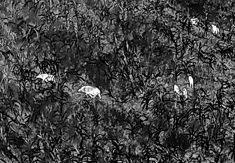
Wildlife management & territory mapping
Professional drone inspection for hunting grounds, wildlife management, and fawn rescue—fast, quiet, and without disturbing the area. Certified special flight authorisation (PDRA/SORA) and authority-ready documentation.
FAQ: Drone inspection for hunting
How does drone search work after wildlife accidents?
Our thermal imaging drone with AI-assisted image analysis locates injured game after wildlife accidents systematically and with GPS precision. The thermal camera detects body heat fully autonomously—even at night and in dense terrain. As a certified gamekeeper, I conduct professional drone searches—for ethical recovery and optimal animal welfare.
How accurate is the counting of red deer and wild boar?
Authority-ready wildlife population surveys with 85–95% accuracy for legally robust cull plans. Double the capture rate vs. traditional methods saves time and provides objective data for lease negotiations and game-damage settlements.
How does the fawn search work before mowing?
Thanks to systematic flight patterns, we detect fawns from sunrise by their heat signatures. Locations are GPS-marked as needed and shared with the farmer. Rescue usually involves relocating them into transport boxes before mowing begins.
Can the drone distinguish wildlife damage from storm damage?
Yes. Our drone inspection clearly distinguishes wildlife damage (feeding traces, rooting) from weather damage. GPS-accurate documentation with high-resolution images enables objective damage assessment and speeds up insurance processing.
Does the drone help with monitoring African swine fever?
Yes. Our thermal imaging drone supports ASF monitoring through autonomous carcass searches, wild boar population surveys, and restricted-area oversight. Documentation is authority-ready for veterinary and disease-control agencies. As a gamekeeper with ASF experience, I understand the specific demands of outbreak control.
What hunting qualifications does FlyHigh have?
Als Jagdschein-Inhaber und geprüfter Jagdaufseher verstehe ich die Bedürfnisse der Jagdpraxis. Kombiniert mit SORA-Zertifizierung für Drohnenflüge biete ich einzigartige Expertise aus Jagd und Drohnentechnik.
Ready for takeoff?
As a licensed hunter and certified gamekeeper, I understand practical hunting needs. Combined with SORA certification for drone flights, I offer unique expertise in both hunting and drone technology.
Safety first: OurOperating authorisations
FlyHigh is authorised for drone operations in Germany, Poland, Switzerland, and Austria—including urban zones and sensitive airspace. Other EU countries can be added within 2–4 weeks.

within populated areas

near critical infrastructure

over plant or construction sites

below regular airspace
The authorisations are based on standardised risk analyses (PDRA/SORA) and require extensive safety measures, which we meet as a certified provider. —